Monitoring recent deformations along the Kenyan Rift using InSAR
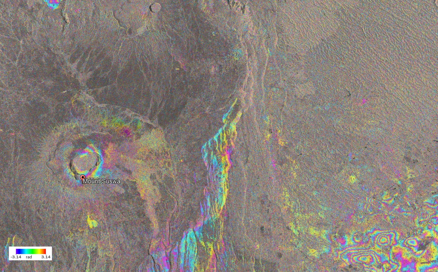
Kenya does not have a functioning geodetic deformation monitoring network due to the high cost of setting and maintaining it. The availability of open-source satellite SAR data and improved InSAR processing algorithms implemented in open source programs have facilitated deformation monitoring in regions like Kenya that was not previously possible. Even though progress in deriving InSAR derived displacements has been made, achieving high accuracy is still a challenge due to tropospheric delay influence. The complex troposphere for tropical regions with challenging terrain like the Kenyan Rift limits the use of existing tropospheric delay mitigation methods, making it challenging to retrieve the deformation signal. Our study aims to quantify recent deformations along the Kenyan Rift using multi-temporal InSAR by optimally modelling the tropospheric delay. The tropospheric delay is estimated based on relationships of the phase components of the interferogram. We utilize LOS measurements from descending and ascending orbits to calculate the pseudo 3D dispalcements. The InSAR derived 3D displacements are validated with GNSS measurements. Preliminary GNSS estimates reveals horizontal movement in the range of approximately 2-3cm/yr at GNSS stations on both sides of the Kenyan Rift. For InSAR, preliminary results show localized deformations at Suswa Volcano and Olkaria. We observe an uplift of approximately 50mm/yr at Suswa volcano and subsidence of approximately 30mm/yr at Olkaria geothermal field for period 2018-2020. The subsidence observed at Olkaria is associated with the exploration of geothermal gas while the uplift at Suswa is attributed to magma movement within the volcano.