SAR Applications in Indonesia: Progress and Development
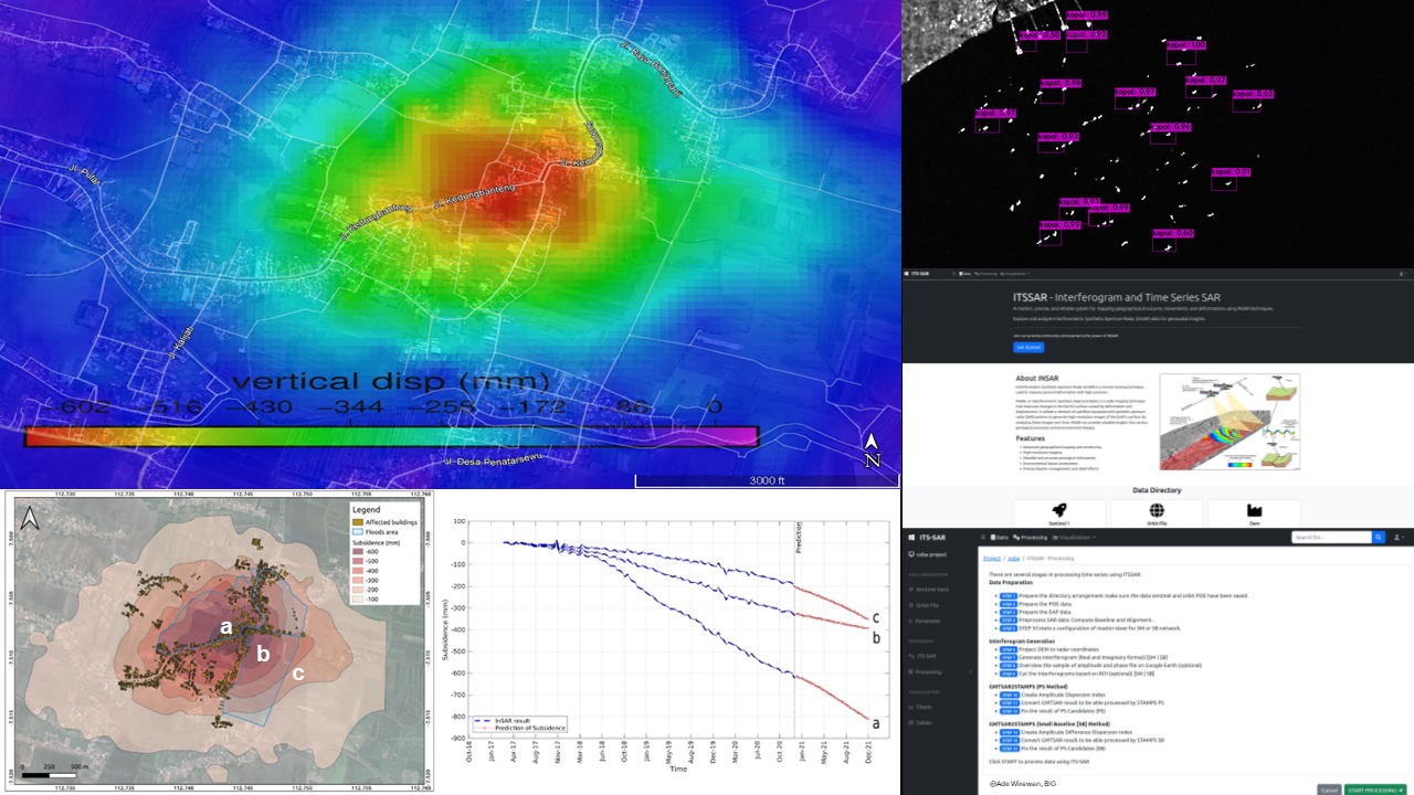
Synthetic Aperture Radar has been used for many decades to monitor the earth's surface due to natural and man-made hazards. In Indonesia, the use of SAR applications has increased in recent years. Several events such as co-seismic deformation caused by earthquakes, volcano deformation, landslide and slope movement, land surface deformation associated with fluid withdrawal, hydrocarbon production, land use change, and degraded peatlands have been successfully observed by InSAR techniques. The inundation areas caused by floods can be mapped by utilizing SAR backscattering and furtherly, it can estimate the loss suffered from floods. Moreover, a new term of SAR data recently can be also used to extract partial precipitable water vapor which supports weather and climate monitoring. Since machine and deep learning have been developed well in SAR applications, the algorithms improved tremendously in SAR processing and analysis. For instance, the prediction of subsidence resulting from the InSAR time series can be approximated in short-term forecasting using deep learning methods. Object detection based on backscattering SAR has been used by machine and deep learning methods and the results are promising. One example is using the technique of You Only Look Once (YOLO) to automatically detect ships in coastal areas. By pursuing this, we performed and evaluated some SAR applications with case studies in Indonesia and progressively built a platform of cloud computing for time series InSAR.